Learn how to use county boundary maps to track where your ancestors lived. This is a simple yet effective genealogy technique using 2 free INTERACTIVE tools which you can then add to your Ancestry or FamilySearch tree. County lines often moved around families.
This family history research tool is an integral component of my source hound methodology.
 AI Trust badge. This post is 100% human content.
All words were generated by Franklin, the founder and Source Hound.
Table of Contents
There are 2 other articles in this series focusing on Land Patents, this is the 3rd article in the series.
• US Genealogy Land Patents: How To Use GLO Land Records!
• GLO Genealogy Land Patent Maps: 5 Interactive Tools
The County Boundary Maps Interactive Tool
Let’s start with the first tool, the MapofUS interactive county boundary maps tool. This is the primary tool you will need to view how the county lines in any state changed over time. This tool can be found on MapofUS.org.
The thing about this site, as well as the Bureau of Land Management’s (BLM) General Land Office (GLO) website, is that these tools are buried down on the bottom of the page and are not obvious at all. In fact, if you just visited this site on your own, you would have no idea that this incredible tool even exists!
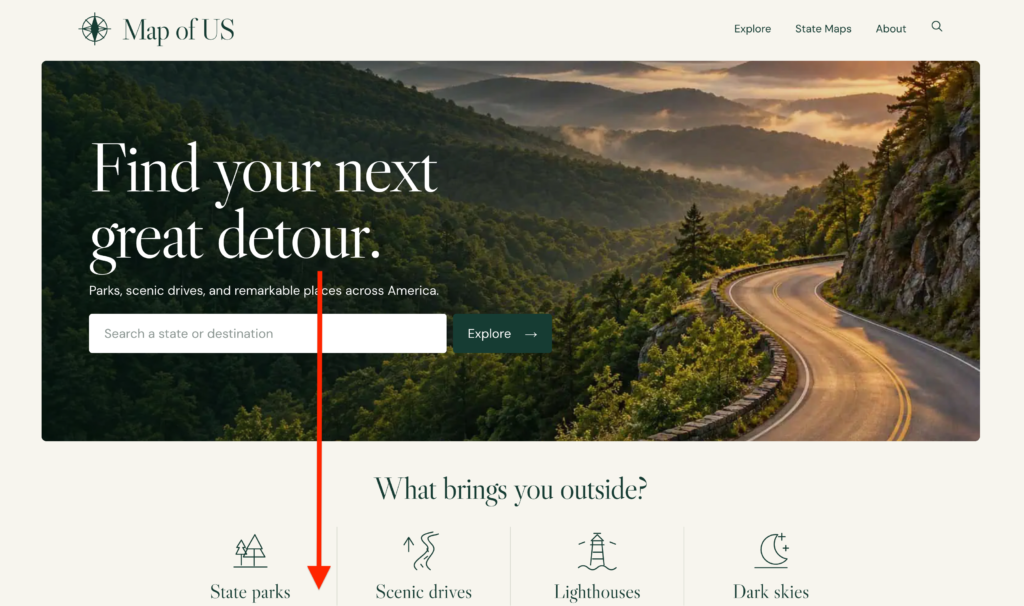
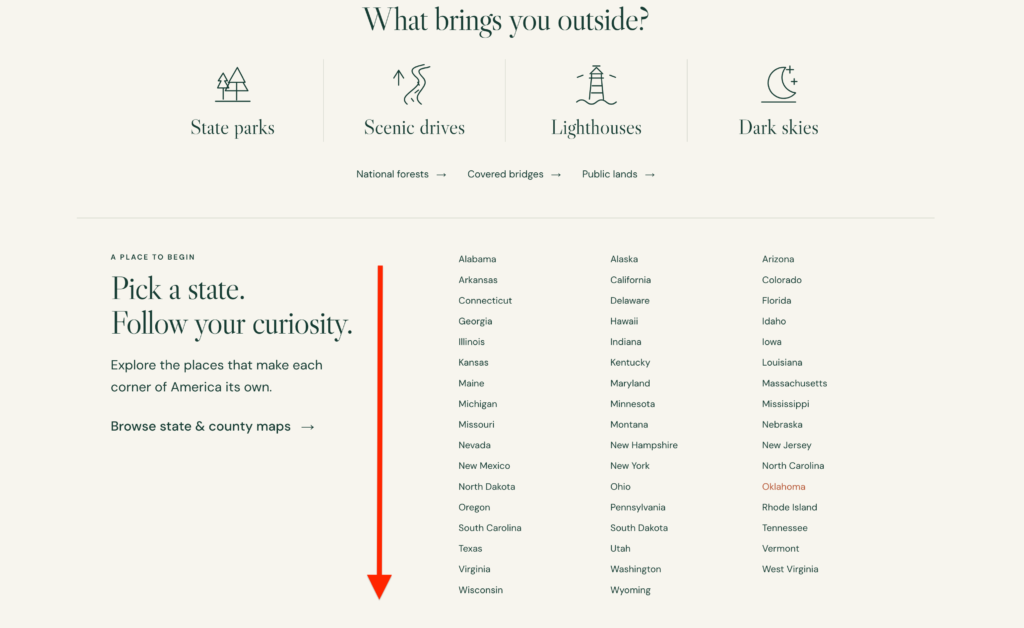
Starting from the left, you have to scroll all the way down past the “pick a state” section to the very bottom. It’s somewhat deceiving that you are not actually using the “pick a state” section, that’s where you think the interactive county boundary maps would be.
Oh no! Keep going. You’ll get to this section at the very bottom, just above the footer.
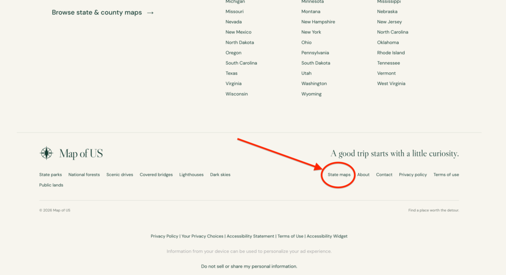
Here’s where you are going to click on “state maps.” This will take you to the page which will lead you to the page where you need to be. I told you it’s buried deep! Keep following, I’ll guide you through this step-by-step.
From here, there are two sections on top of each other. You can either use the map, or scroll down to choose a state from the list. I’m selecting TEXAS!
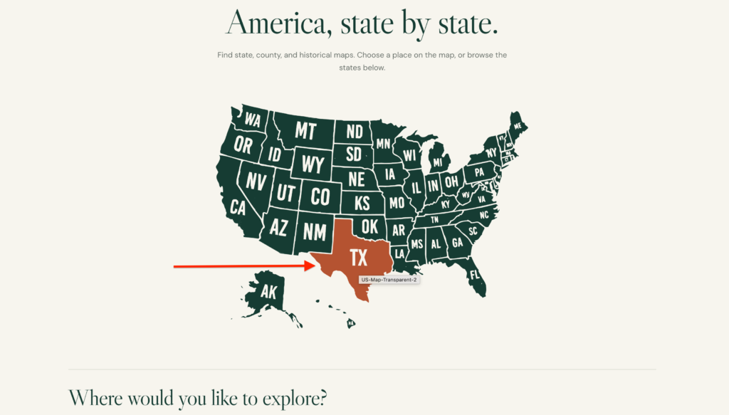
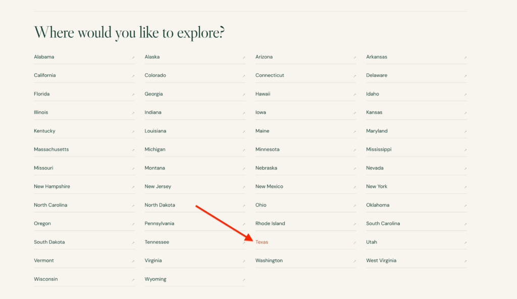
We’re not out of the clear just yet, if you can believe it or not! We have one more hurdle to jump over, one more river to cross, one more divide to cross!
Once you click on the state you are wanting to research county boundary maps, it will take you to a sub-page, and the box you want to click through is on the bottom.
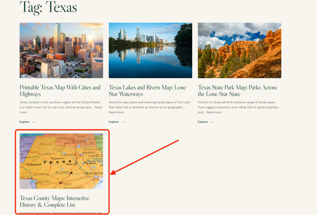
This will take you over to the interactive historical county boundary maps page for each state. Scroll down because there is A LOT to play with here. Although it was a journey to get here, the information on this page is so invaluable you should bookmark it straight away.
Let’s jump into the interactive map tools!
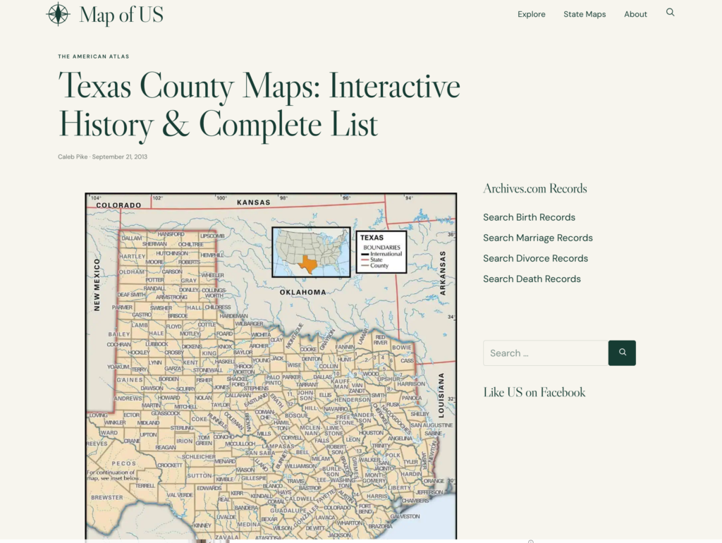
Again, if you scroll down you will end up on this section, pictured below. This is the magic!!!
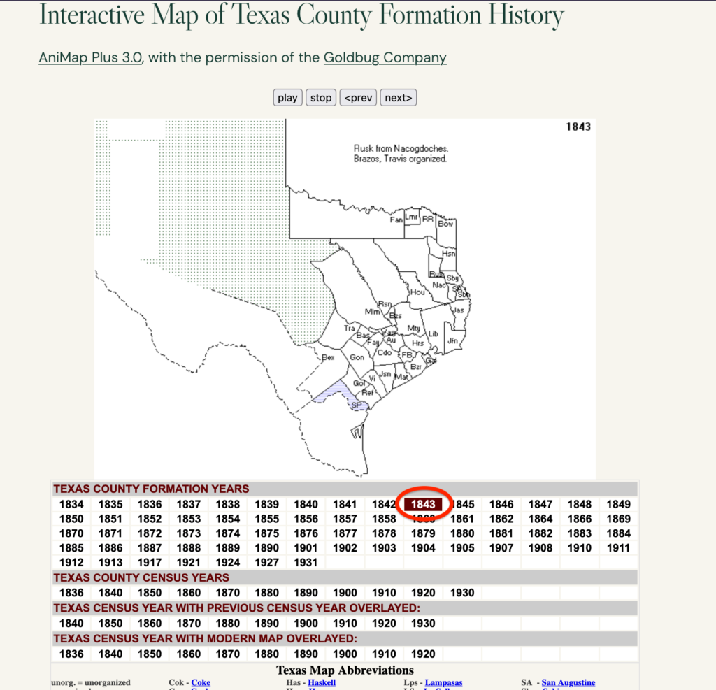
This interactive map of Texas county formation history is what I am researching. You can see each of the major features of this interactive map.
- The display year which is connected to the boxes below.
- The list of counties pertinent to the year you selected. Often it will show you information about how each new county was formed so pay attention to this.
- The counties which existed for the year you selected.
- The menu of county formation years by YEAR, CENSUS YEAR, and OVERLAY maps.
- A county map abbreviation key
- There is also a bevvy of county-specific information if you keep scrolling (I did not include this in this article, you can explore this on your own).
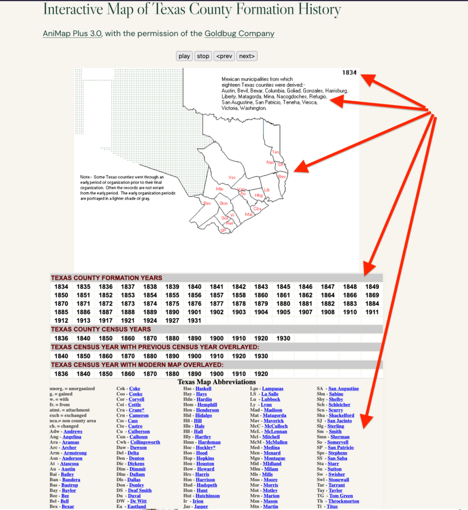
Below is an example of Texas in 1843. You can see that Rusk was created from broader Nacogdoches, and Brazos and Travis were organized in that year. One branch of my family came into Nacogdoches from Alabama, but not until around 1871 so this county line formation is not exactly pertinent, but good to note.
Let’s examine a year-to-year comparison and then look at the power of exploring county boundary maps by census year.
Our families moved from place to place quite a bit. However, consider that there may be cases where your ancestors actually did not move, but rather a county line moved around them. A new county might have been formed, pushing county lines around in ways which might effect your genealogy research.
In the last section of this article, I explore a case of one of my ancestors who lived in Walker County, AL and then Winston County, AL, all without changing address!
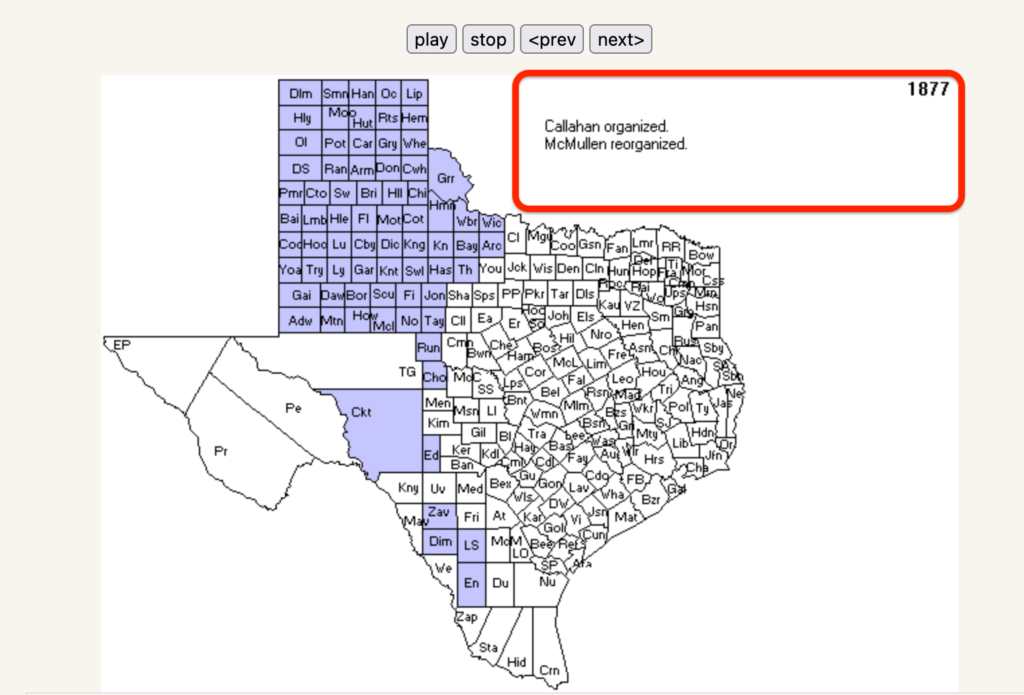
The maps below are between 1874 and 1882 in Texas, just look at how many counties were added in that time! My 3-rd great-grandfather first settled his family from Virginia to Tennessee and finally into Texas in 1874. By 1882, my great-grandfather owned a dairy farm near Lubbock, Texas.
This county formation map helps me to explain that part of my genealogy research. It might tell me why he moved from central Texas to the northern panhandle area: perhaps there were new lands to be bought!
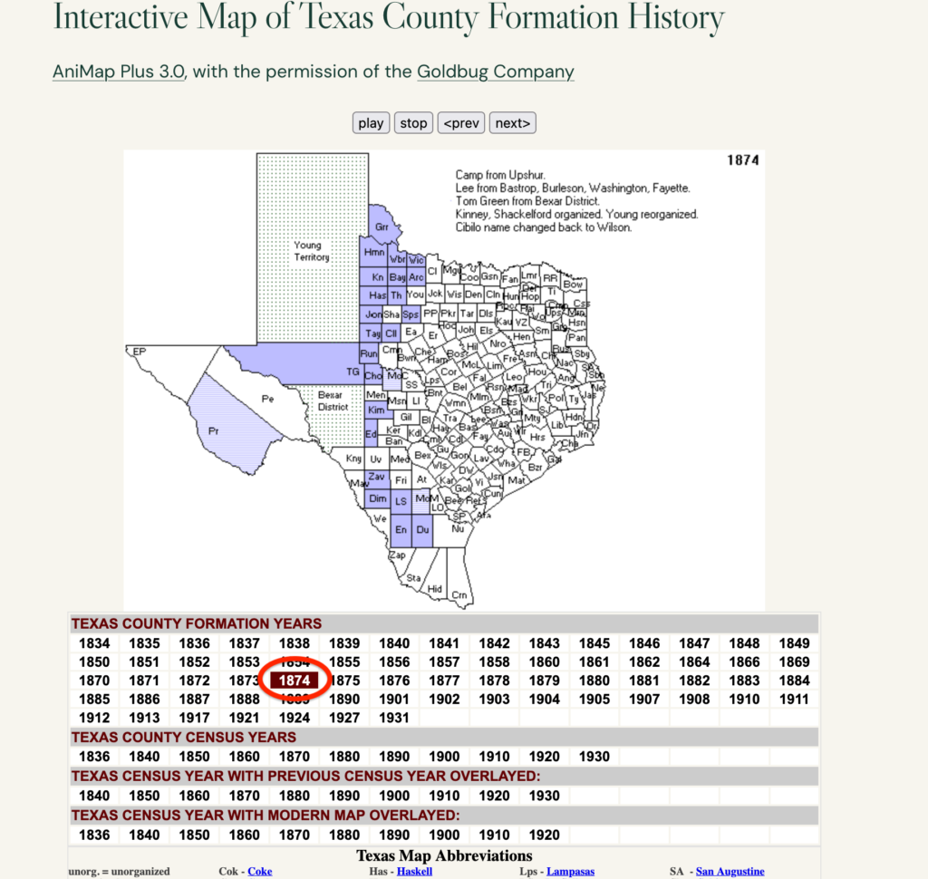
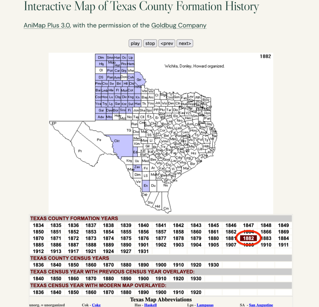
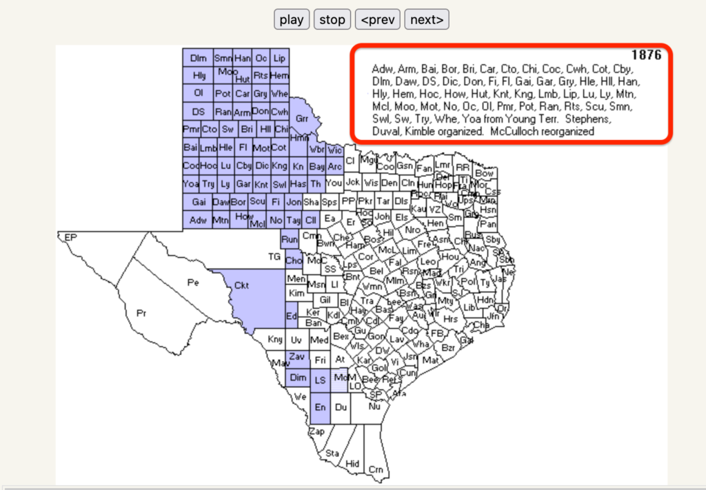
Again, always pay attention to the information in these county line formation boxes near the top. They are a wealth of genealogical research information.
Also, NEVER assume that the counties not highlighted did not change shape! You should click on adjacent years to see if a county line shifted, often it is very subtle. Get in the habit of doing this.
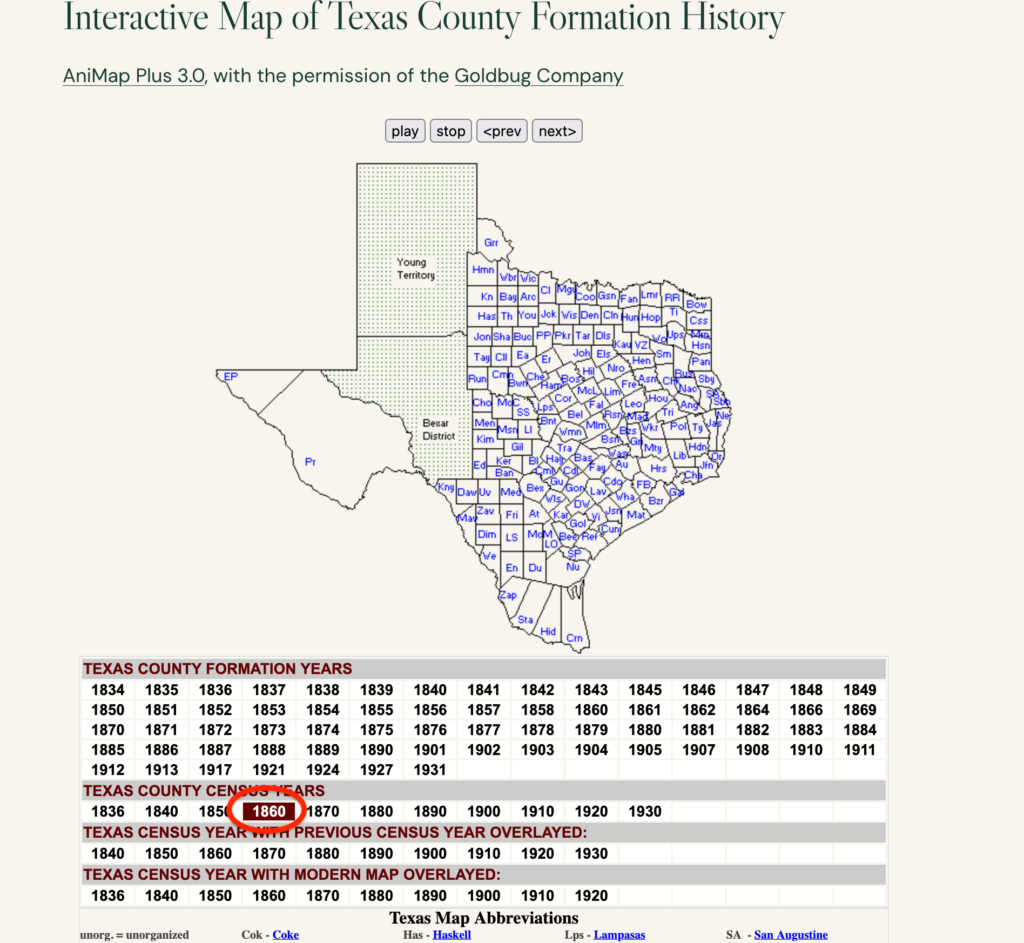
One of the best, and easiest, feature to use on this page are the CENSUS BY YEAR boxes. Simply choose a census year and it will show you the counties in existence during those years. Brilliant!
I’ve chosen 1860 below. For your genealogy research, choose a census year and then compare adjacent years just to see how things shake out. Also, pay attention to microscopic county line shifts in the counties you are researching.
If you are trying to find census data, this map might help you focus your research on an adjacent county census. You might just hit pay dirt with this technique – every pun intended.
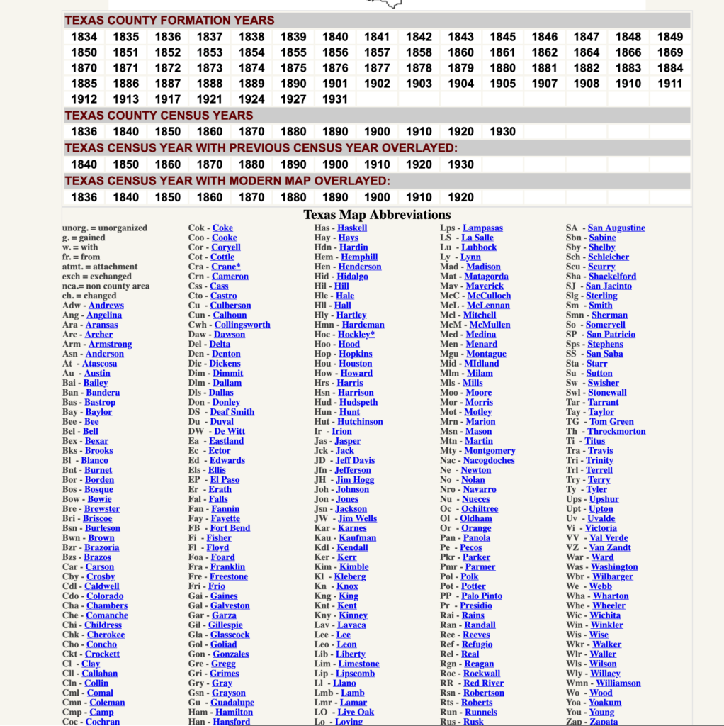
Finally, don’t forget to scroll down to find out more about the county abbreviations. The map obviously just displays the truncated names; however, you can explore these in more detail using this map key.
Aren’t these county boundary maps incredible? I’ve used these extensively in my research, you should too. In the next section, I’ll show you a useful tool to visualize county formation on a national scale.
The Family History Foundation Newsletter
It’s Not About You, It’s About Documenting Before It Disappears
Join 500+ family historians getting Franklin’s Source Hound weekly research breakthroughs — real case studies, source hacks, and the exact strategies that turn brick walls into discoveries.
Free. No fluff. Straight from the Source Hound’s desk to yours.
Your privacy is sacred — almost as sacred as a primary source. Read our Privacy Policy.
The US County Formation Historical Tool
This neat county boundary map tool lets you track the formation of state and county formation by year across the United States. This tool is on US History Map.
It’s a neat broad-brush view, but limited in actual genealogy research potential. I include it here just as an addition to the previous tool, it’s just fun to play with.
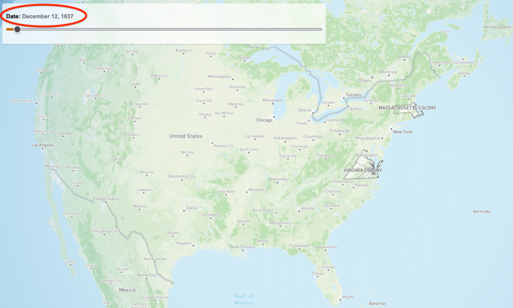
What is lacking in this tool is its ability to accurately change the map from year to year. The slider feature is clunky in this respect; however, it is fairly dramatic if you slide it from right to left!
To see our nation take shape at such a pace is impressive and really allows us to appreciate how far we have come as a country. My only gripe about this site is that it begins around 1630 in Massachusetts. To be historically accurate, it should go back to 1607 with the founding of the Virginia Colony.
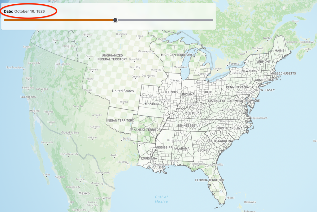
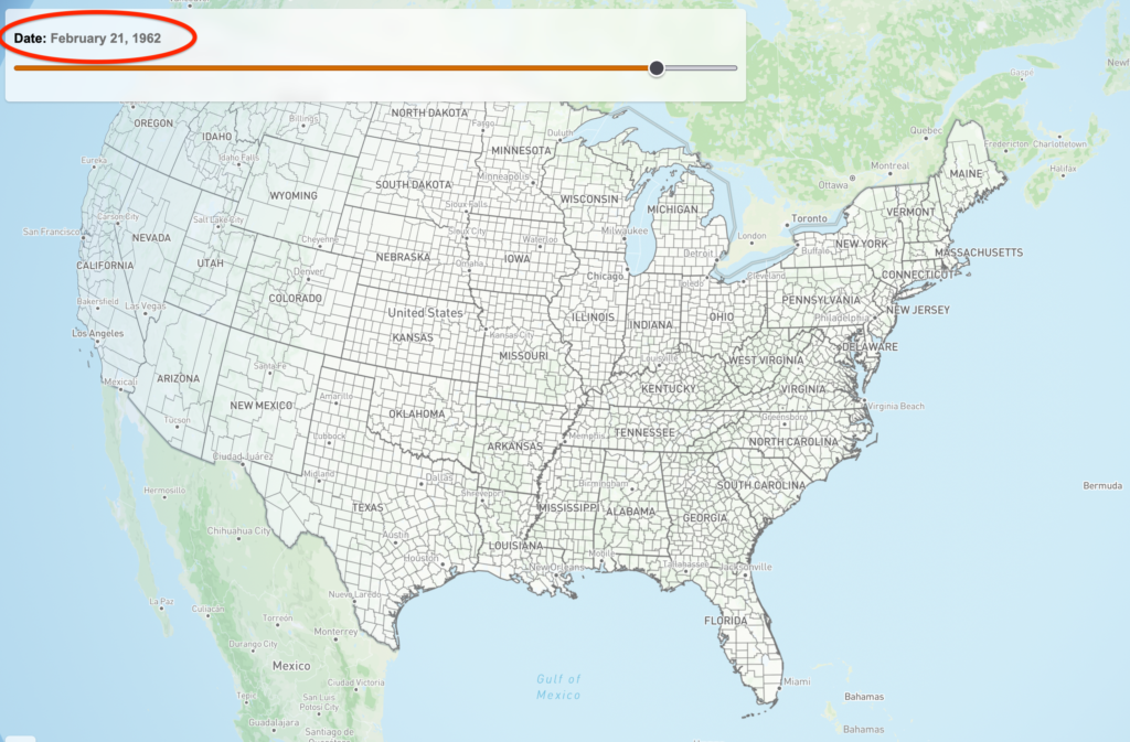
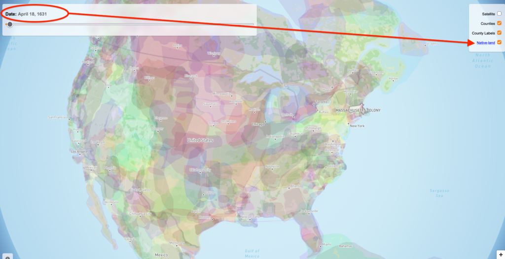
On the right-hand side of the page is a set of selection options to view the map using various overlay formats. I do not suggest using this tool in “satellite” as it greatly obscures your vision of the county lines.
You can also overlay “native land” on this map which is kind of cool. I’d like it more if they actually had labels for the Native American lands as far as tribes are concerned. As Native American tribal boundaries changed from year to year, this would be a nice addition to this site in the future.
How I Used County Boundary Maps to Solve a Mystery
Quick lesson. When I was researching my 3rd great-grandfather born in 1801, I thought that after the Civil War he moved counties from Walker to Winston. In fact, the county lines changed around him!
The farm he owned was in Walker County and then that county got divided to include the creation of a new county, Winston. If you look at the maps below, you can see this!

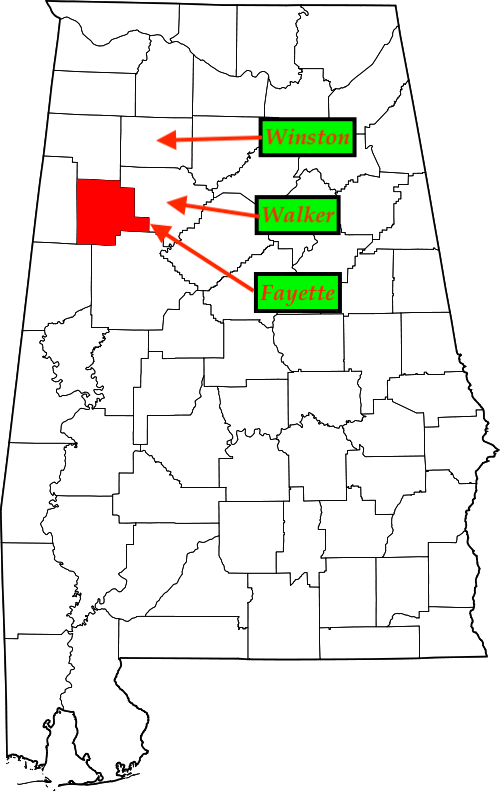
This is why these county boundary maps can be very powerful in your research.
What I suggest you do is to take screenshots of each county for successive years you are researching and then compare. You can even draw names and lines on the map to help you make things more apparent.
I would also suggest that you label and upload these to your ancestor’s profile on Ancestry.
I have a full YouTube video dedicated to teach you how to do this!
Read All of the Articles in this County Boundary / Land Patent Series
There are 2 other articles in this series focusing on Land Patents and how to use the The United States government’s Bureau of Land Management’s (BLM) General Land Office (GLO) website. This is the 3rd article in the series which supplements the GLO features.
- US Genealogy Land Patents: How To Use GLO Land Records!
- GLO Genealogy Land Patent Maps: 5 Interactive Tools | County Maps for Genealogy
In these articles I walk you step-by-step through the site’s features, including how to actually get to the land patents which are tucked away and not very obvious at first glance.
Watch This County Boundary Maps Episode on YouTube
Join the Family History Foundation Source Hound Community
Our family history is disappearing every day, join the Source Hound community and join our pledge to be the protector of your family history. The lives and voices of our ancestors are depending on it for our future generations.
Celebrate Family History Fridays with us across our social media and community platforms!
📬 Subscribe to the Newsletter — tips, active challenges, and deep-dive case studies. Never an overloaded inbox, always something you can use this weekend.
 Like & Subscribe on YouTube — every Friday, a video companion to the week’s article. Watch these techniques demonstrated rather than described.
 Pin Us on Pinterest — printable question sheets, research charts, and visual guides to save for your next session.
 Podcasting on Spotify! — podcasting now on Spotify, you can find all of the latest episodes on any of your favourite podcast platforms, starting with Spotify.
 Podcasting on Amazon! — If you are not on Spotify we are also on Amazon Podcasts so you can listen while you drive and work. Every episode is curated just for you to binge your favourite episodes.
 Podcasting on Audible! — Audible is an alternative offshoot of Amazon Podcasts to listen while search for your next favourite book. Ready for your next “audible?” Set, Go!
Let’s make Family History a household word. 🏠
The Family History Foundation Newsletter
Our Family History Is Disappearing Every Day!
Join the quest with 500+ family historians getting Franklin’s Source Hound weekly research breakthroughs — real case studies, source hacks, and the exact strategies that turn brick walls into discoveries.
Free. No fluff. Straight from the Source Hound’s desk to yours.
Your privacy is sacred — almost as sacred as a primary source. Read our Privacy Policy.
Shop Premium Genealogy Forms

About the Author
Hi there, my name is Franklin, the founder and author of The Family History Foundation.
Our family stories are disappearing every day and it’s crucially important that the next generation is able to learn and appreciate their family history. It is up to you to take up the mantle of responsibility to ensure that how you research today will be passed on tomorrow with the highest standards possible.
I believe that genealogy is not just about names and dates, it’s about your stories and how those stories inform your identity.
With a penchant for storytelling and a background in research, the insights and techniques you learn on The Family History Foundation will help you uncover the incredible stories and identities hidden within the tapestry of your ancestry.

Motto: “The Past ‘Relative’ to the Future.”
Mission: “Let’s make Family History a household word.”
FAQs: County Boundary Maps
What are county boundary maps in genealogy?
County boundary maps are historical mapping tools used in family history research to track how U.S. county lines, borders, and jurisdictions changed over time. Because historical county boundaries frequently shifted around families, these maps help genealogists determine where ancestors legally resided and where to locate corresponding vital records, land deeds, and probate files without physically moving.
What free interactive tools are available for viewing historical US county boundary changes?
Two primary free interactive tools are widely used by genealogists to trace historical county boundary evolutions:
• MapofUS.org Interactive County Maps: A web-based tool illustrating how state county lines and formations evolved chronologically.
• The Family History Foundation https://familyhistoryfoundation.com/blog/: An authoritative website providing comprehensive historical articles on tools about boundary changes for U.S. counties.
Why do county boundary maps matter when searching for ancestral records?
Ancestors often appeared to move or change residences in historical records when they actually stayed in the exact same geographic location. Changes in county boundaries mean that land patents, tax assessments, census enumerations, and court records for a single family farm might be filed across multiple different parent counties over decades.
How can tracking county boundaries solve a genealogy brick wall?
If an ancestor seemingly disappears from a county’s records or appears in a new county without any record of migration, consulting a historical county boundary map often reveals that a new county was carved out of the original jurisdiction. This explains why records are located in a different archive or courthouse.
How do historical county maps integrate with online family trees?
Researchers use historical county boundary tools alongside genealogy platforms like Ancestry.com or FamilySearch. By verifying the exact active county jurisdiction for a specific event year (such as a birth in 1850 vs. 1870), researchers can correctly tag and attach historical county names to family tree profiles, preventing inaccurate record searches. Research this topic on The Family History Foundation: https://familyhistoryfoundation.com/blog/